
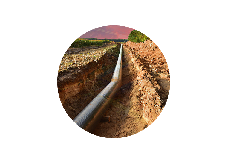
Oil & Gas
How well do you know your assets?
Oil & Gas
How well do you know your assets?
WHAT WE DO
Our hydrographic expertise includes the most challenging of aquatic environments from shallowest inland waters to the deep ocean. Using our fleet of calibrated survey vessels or aboard ships offshore, we provide our clients with high resolution bathymetric, acoustic backscatter, and water column data that strictly adhere to the highest IHO, USACE and NOAA charting standards.
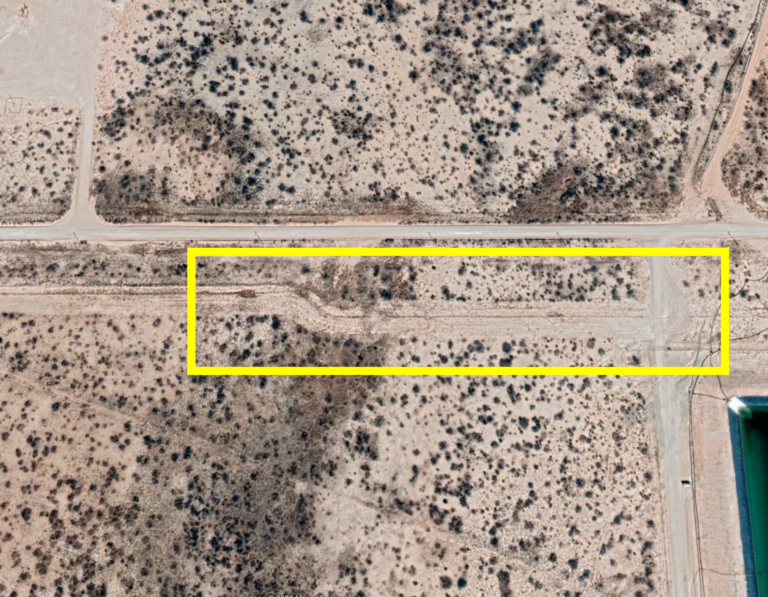
corridor mapping
Monitor and maintain right-of-way corridors for vegetation management, HCA compliance, pipeline integrity, leak detection, and more.
Asset Management
Elevate management programs with digital twin technology for asset inventory and infrastructure assessments.
Offshore Survey
We support the oil & gas industry with hydrographic survey in both offshore and nearshore environments for siting, exploration, and environmental study.
Contact Us

NV5 has held the Esri Platinum Partner status in the Esri Partner Network since 2010 and maintains seven Esri specialty designations, NV5’s staff are experienced and maintain key certifications across the Esri environment.
Not All Boats are Created Equal – The Importance of Dedicated Marine Survey Vessels for Offshore Wind Siting
Learn how NV5 utilizes their dedicated fleet to perform deep sea and nearshore bathymetric survey in the latest issue of Ocean News & Technology Learn more
NV5 recognized by MAPPS for outstanding work in coastal resiliency via bathymetry mapping in Laguna Madre, TX
NV5 earned the Excellence Award in Surveying/Field Data Collection, announced at the 2023 MAPPS Winter Conference. Learn more
NOAA Selects NV5 for Extensive Hydrographic Survey in North Carolina
A task order features unique survey approach to deliver valuable charting data that will also support environmental and coastal resilience efforts. Learn more
Digital Twin
Vegetation Management
HCA Analysis
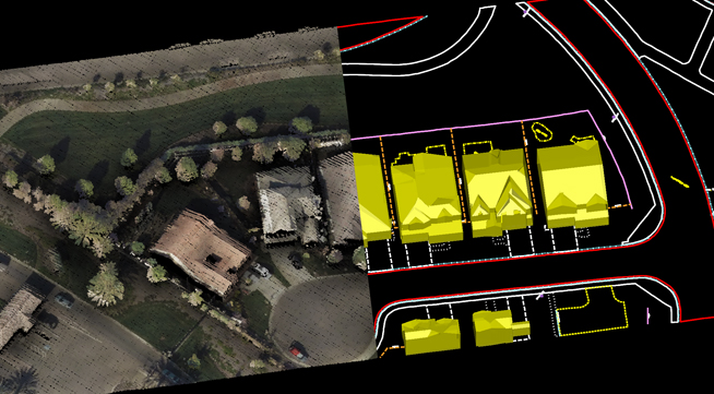
3D buildings generated directly from lidar data, combined with orthoimagery, HD videography or oblique imagery are utilized in NV5 Geospatial’s pipeline HCA and class location studies. Buildings along the pipeline ROW are attributed with parcel data, building use and size, then calculated along a sliding mile using our automated building count routine.

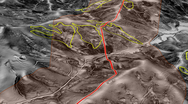
Geohazards
Identify and mitigate potential geologic hazard threats to both pipeline ROW and building infrastructure utilizing our proprietary terrain failure and fault detection and proximity analysis solutions. Utilizing an automated approach, NV5 Geospatial’s methodology offers an accurate and efficient way to detect areas of failed terrain using high-resolution lidar.
Pipeline Integrity
Above-ground pipeline supports are subject to settlement and heave due to the yearly freeze and thaw cycle as well as water movements and other terrain failures. These movements can threaten the integrity of sensitive infrastructure. Pipelines are engineered with a tolerance for movement, however alignment and declination must be routinely inspected along the line in order to find areas of stress that are exceeding established tolerances.
NV5 Geospatial’s solution utilizes high-density aerial lidar to map the pipelines and supports in detail. Precise pipeline elevation values at support structures are extracted from the point cloud and recorded in a geodatabase. This database is then analyzed to find areas of stress. NV5 Geospatial can integrate this analysis with existing asset information or utilize the newly collected data to create an updated inventory. Repeat surveys can be added to the geodatabase to monitor changes at specific structures over time, providing integrity managers a powerful planning tool.
Buried Pipeline Survey
Identify, map, and model buried pipe with NV5 remote sensing analysis.
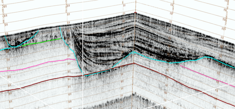
Offshore Survey
NV5 is a leader in offshore hydrographic survey, including specialized experience in coastal zone waters where conditions are dynamic. NV5 is one of only 2 contractors capable of both deep sea and shallow water survey.
Thermal Analysis
Detect infrastructure issues with thermal infrared scanning. Analysis reveals early signs of component failure, allowing you to make repairs before problems arise.

Oil & Gas
A Pipeline of Knowledge
Data Driven Decisions
NV5 Geospatial’s core offerings for the oil & gas industry are based upon a solid foundation of quality data. High resolution point clouds and orthoimagery delivered at or above client specifications populate land base information for our clients. In the last 2 years alone, NV5 Geospatial has collected orthoimagery and point cloud information for well over 40,000 pipeline corridor miles. Building upon the high volume of precise land base data, NV5 Geospatial is also able to provide many valuable analytic products that enhance the safe and reliable operation of oil and gas pipelines. Our analytic solutions include: Structure Classification, Vegetation Characterization, Encroachment Analysis, Terrain Hazard Analysis, Corridor Change Detection, Emergency Response Data Capture, Greenfield Survey, Above-ground Pipeline Integrity Analysis, Asset Road Access, and Environmental Evaluations.
Pipeline Integrity Analysis
Above-ground pipeline supports are subject to settlement and heave due to the yearly freeze and thaw cycle as well as water movements and other terrain failures. These movements can threaten the integrity of sensitive infrastructure. Pipelines are engineered with a tolerance for movement, however alignment and declination must be routinely inspected along the line in order to find areas of stress that are exceeding established tolerances.
NV5 Geospatial’s solution utilizes high-density aerial lidar to map the pipelines and supports in detail. Precise pipeline elevation values at support structures are extracted from the point cloud and recorded in a geodatabase. This database is then analyzed to find areas of stress. NV5 Geospatial can integrate this analysis with existing asset information or utilize the newly collected data to create an updated inventory. Repeat surveys can be added to the geodatabase to monitor changes at specific structures over time, providing integrity managers a powerful planning tool.
Exploration
Whether utilizing airborne lidar to identify lineaments, thermal IR to identify surface thermal anomalies, or hyperspectral technology for the characterization of surface geology and minerals, NV5 Geospatial’s Geosciences team has expertise in applied remote sensing for oil & gas exploration.
Pre-Construction Siting
Through a highly automated process, our team produces planimetric mapping directly from high resolution lidar points to support pre-construction design or siting analysis. The result is a cost-efficient alternative to ground intensive surveys, whether mapping dense urban areas or remote areas with challenging terrain.
Environmental Monitoring
NV5 Geospatial has extensive experience with environmental mapping and monitoring solutions such as surface mapping for erosion control, vegetation baselines and change detection as well as wetland delineation to support mitigation and impact studies. Our team also provides monitoring for methane leak detection and environmental disturbances along existing pipeline corridors.
HCA Identification and Class Location Analysis
3D buildings generated directly from lidar data, combined with orthoimagery, HD videography or oblique imagery are utilized in NV5 Geospatial’s pipeline HCA and class location studies. Buildings along the pipeline ROW are attributed with parcel data, building use and size, then calculated along a sliding mile using our automated building count routine.
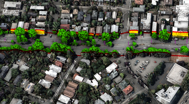
ROW Encroachment Detection
NV5 Geospatial provides unique solutions and visualization tools for ROW encroachment and change detection analysis. HD Videography paired with lidar analytics along a ROW allow a desktop walk of the pipeline corridor to identify priority areas before deploying field crews.
Vegetation Management
Comply with recent FAA clearance requirements and execute safe and reliable night flights and airport approaches. Our best-in-class vegetation management solutions include clearance detection and minimum clearance analytics, hazard tree detection, and change detection.